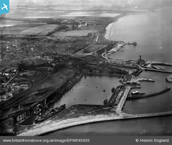
EPW045933 ENGLAND (1934). South Dock and environs, Seaham, 1934
© Copyright OpenStreetMap contributors and licensed by the OpenStreetMap Foundation. 2024. Cartography is licensed as CC BY-SA.
Details
| Title | [EPW045933] South Dock and environs, Seaham, 1934 |
| Reference | EPW045933 |
| Date | August-1934 |
| Link | |
| Place name | SEAHAM |
| Parish | SEAHAM |
| District | |
| Country | ENGLAND |
| Easting / Northing | 443190, 549359 |
| Longitude / Latitude | -1.3274757844058, 54.837096912968 |
| National Grid Reference | NZ432494 |
Pins
 Alan Baker |
Thursday 25th of July 2024 10:55:06 AM | |
 J May |
Friday 9th of April 2021 03:09:44 PM | |
 J May |
Friday 9th of April 2021 03:08:56 PM | |
 MeccanoMan |
Saturday 7th of November 2020 11:08:45 AM | |
 Martin |
Thursday 22nd of November 2018 02:15:39 PM | |
 micksmith |
Sunday 11th of October 2015 12:15:16 PM | |
 micksmith |
Sunday 11th of October 2015 12:14:37 PM | |
 micksmith |
Sunday 11th of October 2015 12:14:04 PM | |
 micksmith |
Sunday 11th of October 2015 12:13:00 PM | |
 micksmith |
Sunday 11th of October 2015 12:00:06 PM | |
 micksmith |
Sunday 11th of October 2015 11:59:27 AM | |
 micksmith |
Sunday 11th of October 2015 11:58:09 AM | |
 micksmith |
Sunday 11th of October 2015 11:52:16 AM |
User Comment Contributions
Interesting to see that the Irish BAck Streets were still standing. I thought that they were demolished and replaced by Tyne and Wear streets in the 30's. Clearly post 1934 |
 micksmith |
Sunday 11th of October 2015 12:18:01 PM |


