
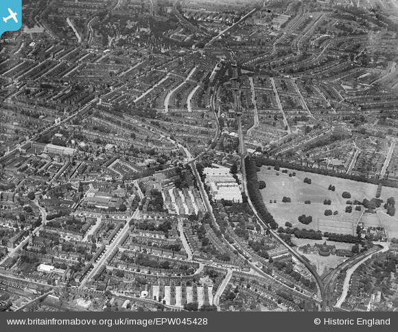
EPW045428 ENGLAND (1934). Shacklewell and Upper Clapton, Stoke Newington, from the south-east, 1934
© Copyright OpenStreetMap contributors and licensed by the OpenStreetMap Foundation. 2026. Cartography is licensed as CC BY-SA.
Details
| Title | [EPW045428] Shacklewell and Upper Clapton, Stoke Newington, from the south-east, 1934 |
| Reference | EPW045428 |
| Date | July-1934 |
| Link | |
| Place name | STOKE NEWINGTON |
| Parish | |
| District | |
| Country | ENGLAND |
| Easting / Northing | 534174, 185438 |
| Longitude / Latitude | -0.064566340410569, 51.551377502151 |
| National Grid Reference | TQ342854 |
Pins

ABL |
Tuesday 27th of April 2021 02:37:16 PM | |
|
Tim C |
Thursday 8th of August 2019 12:05:38 PM | |
|
Pebbs |
Thursday 4th of October 2018 07:47:55 AM | |
|
Pebbs |
Thursday 4th of October 2018 07:47:51 AM | |
|
Pebbs |
Thursday 4th of October 2018 07:38:08 AM | |
|
Pebbs |
Thursday 4th of October 2018 07:31:32 AM | |
|
Pebbs |
Thursday 4th of October 2018 07:31:02 AM | |
|
Pebbs |
Thursday 4th of October 2018 07:18:01 AM | |
|
Pebbs |
Thursday 4th of October 2018 07:16:23 AM | |
|
FandF |
Tuesday 31st of December 2013 10:20:02 PM | |
|
FandF |
Tuesday 31st of December 2013 10:10:35 PM | |
|
Parish historian |
Friday 31st of May 2013 03:50:58 PM |