
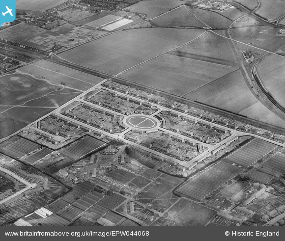
EPW044068 ENGLAND (1934). Residential area surrounding The Link, Enfield, 1934
© Copyright OpenStreetMap contributors and licensed by the OpenStreetMap Foundation. 2024. Cartography is licensed as CC BY-SA.
Details
| Title | [EPW044068] Residential area surrounding The Link, Enfield, 1934 |
| Reference | EPW044068 |
| Date | April-1934 |
| Link | |
| Place name | ENFIELD |
| Parish | |
| District | |
| Country | ENGLAND |
| Easting / Northing | 536253, 197907 |
| Longitude / Latitude | -0.029749615530893, 51.662938518744 |
| National Grid Reference | TQ363979 |
Pins
 Ray Flack |
Saturday 7th of November 2015 02:31:17 PM | |
Ray Flack |
Thursday 7th of November 2013 05:28:43 PM | |
Ray Flack |
Thursday 7th of November 2013 05:27:40 PM | |
Ray Flack |
Thursday 7th of November 2013 05:26:52 PM | |
Ray Flack |
Thursday 7th of November 2013 05:26:29 PM | |
Ray Flack |
Thursday 7th of November 2013 05:24:09 PM | |
Ray Flack |
Thursday 7th of November 2013 05:23:34 PM |