
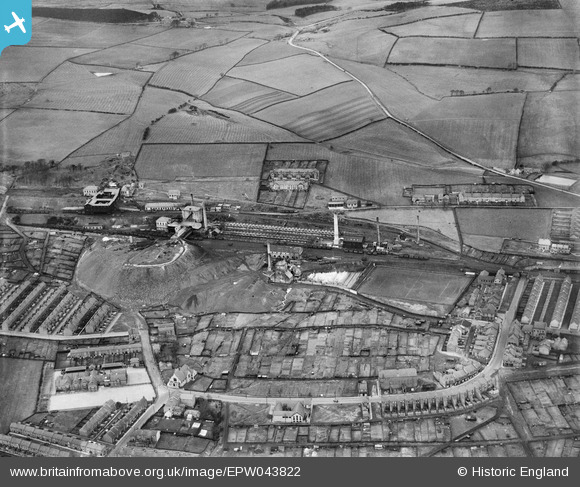
EPW043822 ENGLAND (1934). Chopwell Colliery (Pit No 1) and environs, Chopwell, 1934
© Copyright OpenStreetMap contributors and licensed by the OpenStreetMap Foundation. 2026. Cartography is licensed as CC BY-SA.
Details
| Title | [EPW043822] Chopwell Colliery (Pit No 1) and environs, Chopwell, 1934 |
| Reference | EPW043822 |
| Date | March-1934 |
| Link | |
| Place name | CHOPWELL |
| Parish | |
| District | |
| Country | ENGLAND |
| Easting / Northing | 411677, 558541 |
| Longitude / Latitude | -1.8177956216049, 54.921345067468 |
| National Grid Reference | NZ117585 |
Pins

russellwynn@mail.com |
Wednesday 13th of March 2024 09:23:35 PM | |
|
russellwynn@mail.com |
Wednesday 13th of March 2024 09:21:24 PM | |
|
MOT |
Wednesday 18th of January 2017 06:51:46 PM | |
|
MOT |
Wednesday 18th of January 2017 06:50:47 PM | |
|
MOT |
Wednesday 18th of January 2017 06:49:50 PM |