
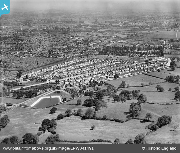
EPW041491 ENGLAND (1933). Housing estate centred upon Finlay Road, and the Gloucester Corporation Water Works, Gloucester, from the south-east, 1933
© Copyright OpenStreetMap contributors and licensed by the OpenStreetMap Foundation. 2026. Cartography is licensed as CC BY-SA.
Details
| Title | [EPW041491] Housing estate centred upon Finlay Road, and the Gloucester Corporation Water Works, Gloucester, from the south-east, 1933 |
| Reference | EPW041491 |
| Date | June-1933 |
| Link | |
| Place name | GLOUCESTER |
| Parish | |
| District | |
| Country | ENGLAND |
| Easting / Northing | 383957, 215863 |
| Longitude / Latitude | -2.2328876349152, 51.840696854721 |
| National Grid Reference | SO840159 |
Pins

bubble |
Sunday 27th of August 2017 06:55:35 PM | |
|
bubble |
Sunday 27th of August 2017 06:47:39 PM | |
|
bubble |
Sunday 27th of August 2017 06:41:59 PM | |

Maurice |
Sunday 19th of May 2013 08:01:23 AM | |
|
Maurice |
Sunday 19th of May 2013 08:00:02 AM | |
This is part of the Midland Railway's main line through Gloucester, built in the late C19th when Eastgate Station was constructed. The railway is about to rejoin the through lines at Tuffley Junction out of the photograph to the left. As late as 1970 most of the trains from Birmingham to Bristol used this route unless they were not timetabled to stop at Gloucester (less common in those days). There were five level crossings within a couple of miles on this route, which at least partly led to the sad closure of Eastgate and the loop in about 1972. |
Toby Clempson |
Thursday 21st of November 2013 07:20:00 AM |