
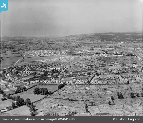
EPW041486 ENGLAND (1933). Housing estates at Knowle Park and Lower Knowle, Knowle, from the east, 1933
© Copyright OpenStreetMap contributors and licensed by the OpenStreetMap Foundation. 2026. Cartography is licensed as CC BY-SA.
Details
| Title | [EPW041486] Housing estates at Knowle Park and Lower Knowle, Knowle, from the east, 1933 |
| Reference | EPW041486 |
| Date | June-1933 |
| Link | |
| Place name | KNOWLE |
| Parish | |
| District | |
| Country | ENGLAND |
| Easting / Northing | 360737, 170405 |
| Longitude / Latitude | -2.5648467010994, 51.430794767221 |
| National Grid Reference | ST607704 |
Pins

Geoff |
Tuesday 5th of August 2014 02:13:36 PM | |

Class31 |
Wednesday 26th of February 2014 11:13:28 PM | |
|
Class31 |
Wednesday 26th of February 2014 11:12:31 PM | |
|
Class31 |
Wednesday 26th of February 2014 11:11:58 PM | |
|
Class31 |
Wednesday 26th of February 2014 11:10:54 PM | |
|
Class31 |
Wednesday 26th of February 2014 11:09:07 PM | |
|
Class31 |
Wednesday 26th of February 2014 11:08:13 PM | |
|
Class31 |
Wednesday 26th of February 2014 11:07:25 PM | |
|
Class31 |
Wednesday 26th of February 2014 11:05:52 PM | |
|
Class31 |
Wednesday 26th of February 2014 11:05:13 PM |