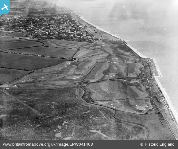
EPW041408 ENGLAND (1933). Frinton Golf Course, Frinton-On-Sea, from the south-west, 1933
© Copyright OpenStreetMap contributors and licensed by the OpenStreetMap Foundation. 2024. Cartography is licensed as CC BY-SA.
Details
| Title | [EPW041408] Frinton Golf Course, Frinton-On-Sea, from the south-west, 1933 |
| Reference | EPW041408 |
| Date | May-1933 |
| Link | |
| Place name | FRINTON-ON-SEA |
| Parish | FRINTON AND WALTON |
| District | |
| Country | ENGLAND |
| Easting / Northing | 622487, 218078 |
| Longitude / Latitude | 1.2283956062562, 51.816520486719 |
| National Grid Reference | TM225181 |
Pins
 Mike Richardson |
Saturday 1st of March 2014 03:57:40 PM |

