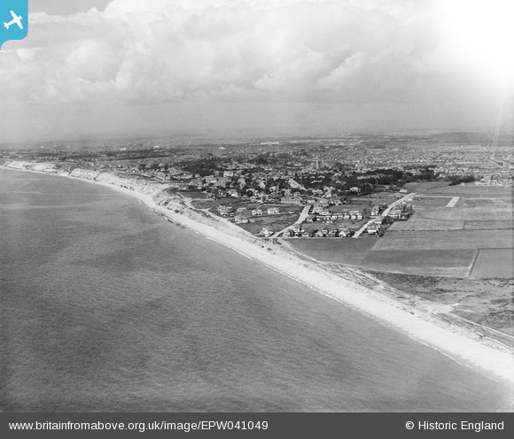
EPW041049 ENGLAND (1933). Southbourne Cliff Drive, the cliffs and the town, West Southbourne, from the south-east, 1933
© Copyright OpenStreetMap contributors and licensed by the OpenStreetMap Foundation. 2024. Cartography is licensed as CC BY-SA.
Details
| Title | [EPW041049] Southbourne Cliff Drive, the cliffs and the town, West Southbourne, from the south-east, 1933 |
| Reference | EPW041049 |
| Date | April-1933 |
| Link | |
| Place name | WEST SOUTHBOURNE |
| Parish | |
| District | |
| Country | ENGLAND |
| Easting / Northing | 415449, 90812 |
| Longitude / Latitude | -1.7811448240661, 50.716157339968 |
| National Grid Reference | SZ154908 |
Pins
 Ade |
Saturday 20th of March 2021 05:36:38 PM | |
 Class31 |
Tuesday 9th of September 2014 02:59:46 PM | |
 Class31 |
Thursday 31st of October 2013 11:34:19 PM | |
 Class31 |
Thursday 31st of October 2013 11:33:19 PM | |
 Class31 |
Thursday 31st of October 2013 11:31:54 PM |

