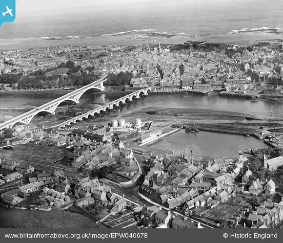
EPW040678 ENGLAND (1932). Tweed Dock, the bridges and the town, Berwick-upon-Tweed, from the south-west, 1932
© Copyright OpenStreetMap contributors and licensed by the OpenStreetMap Foundation. 2025. Cartography is licensed as CC BY-SA.
Details
| Title | [EPW040678] Tweed Dock, the bridges and the town, Berwick-upon-Tweed, from the south-west, 1932 |
| Reference | EPW040678 |
| Date | October-1932 |
| Link | |
| Place name | BERWICK-UPON-TWEED |
| Parish | BERWICK-UPON-TWEED |
| District | |
| Country | ENGLAND |
| Easting / Northing | 399443, 652370 |
| Longitude / Latitude | -2.0088778888984, 55.764695561949 |
| National Grid Reference | NT994524 |
Pins

melgibbs |
Tuesday 7th of November 2017 07:47:04 PM | |

melgibbs |
Wednesday 14th of October 2015 06:37:06 PM | |

melgibbs |
Wednesday 14th of October 2015 05:44:17 PM |


