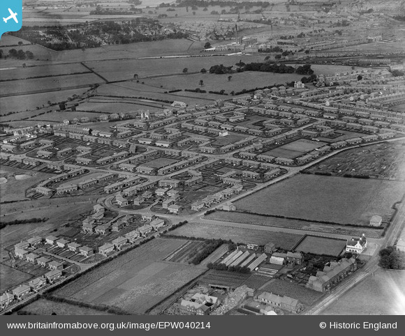
EPW040214 ENGLAND (1932). New housing estate at Buchanan Road and environs, Currock, 1932
© Copyright OpenStreetMap contributors and licensed by the OpenStreetMap Foundation. 2026. Cartography is licensed as CC BY-SA.
Details
| Title | [EPW040214] New housing estate at Buchanan Road and environs, Currock, 1932 |
| Reference | EPW040214 |
| Date | 7-September-1932 |
| Link | |
| Place name | CURROCK |
| Parish | |
| District | |
| Country | ENGLAND |
| Easting / Northing | 340558, 553836 |
| Longitude / Latitude | -2.9264788586963, 54.875663180401 |
| National Grid Reference | NY406538 |
Pins

Stewart Thompson |
Monday 21st of February 2022 01:23:41 AM | |

Stewart Thompson |
Monday 21st of February 2022 01:22:51 AM | |

Stewart Thompson |
Monday 21st of February 2022 01:22:29 AM | |

Stewart Thompson |
Monday 21st of February 2022 01:21:42 AM | |

Stewart Thompson |
Monday 21st of February 2022 01:20:24 AM | |

border reiver |
Friday 12th of August 2016 10:17:13 PM | |

gBr |
Wednesday 3rd of December 2014 04:02:34 PM | |

gBr |
Wednesday 3rd of December 2014 03:59:51 PM |

