
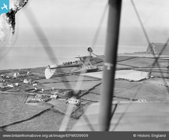
EPW039909 ENGLAND (1932). Upton, Flight Lieutenant Turner Hughes flying DH82A G-ABUL inverted during the National Aviation Day Display, 1932. This image has been produced from a damaged negative.
© Copyright OpenStreetMap contributors and licensed by the OpenStreetMap Foundation. 2026. Cartography is licensed as CC BY-SA.
Details
| Title | [EPW039909] Upton, Flight Lieutenant Turner Hughes flying DH82A G-ABUL inverted during the National Aviation Day Display, 1932. This image has been produced from a damaged negative. |
| Reference | EPW039909 |
| Date | 22-August-1932 |
| Link | |
| Place name | UPTON |
| Parish | BUDE-STRATTON |
| District | |
| Country | ENGLAND |
| Easting / Northing | 220326, 104816 |
| Longitude / Latitude | -4.5508208432477, 50.814420378747 |
| National Grid Reference | SS203048 |
Pins

Mike Holder |
Tuesday 23rd of June 2020 03:20:12 PM |
User Comment Contributions
Thank you for locating this; we have no information on location from the original Aerofilms Ltd Register entry. We'll update the catalogue and post the new record here in due course. Yours, Katy Britain from Above Cataloguing Team Leader |
Katy Whitaker |
Tuesday 2nd of July 2013 12:10:00 PM |
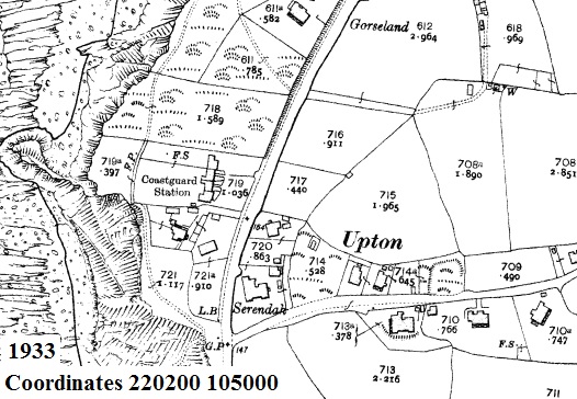
Just agreeing with Dave B and adding a map. Main features in the photo can be found on the map, e.g. the large light field, the house at bottom left, field boundaries, etc. |
ewnmcg |
Friday 14th of June 2013 06:51:22 PM |
View looking west over Upton |
Dave Brunt |
Sunday 2nd of June 2013 01:22:14 AM |