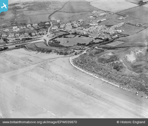
EPW039870 ENGLAND (1932). The beach and the village, Woolacombe, 1932
© Copyright OpenStreetMap contributors and licensed by the OpenStreetMap Foundation. 2024. Cartography is licensed as CC BY-SA.
Details
| Title | [EPW039870] The beach and the village, Woolacombe, 1932 |
| Reference | EPW039870 |
| Date | August-1932 |
| Link | |
| Place name | WOOLACOMBE |
| Parish | MORTEHOE |
| District | |
| Country | ENGLAND |
| Easting / Northing | 245678, 143535 |
| Longitude / Latitude | -4.2076606137151, 51.169686176359 |
| National Grid Reference | SS457435 |
Pins
 John Llewellyn |
Monday 11th of January 2016 10:37:55 AM |


![[EPW039870] The beach and the village, Woolacombe, 1932](http://britainfromabove.org.uk/sites/all/libraries/aerofilms-images/public/100x100/EPW/039/EPW039870.jpg)
![[EPW033450] Beach huts along Woolacombe Sand and the village, Woolacombe, 1930](http://britainfromabove.org.uk/sites/all/libraries/aerofilms-images/public/100x100/EPW/033/EPW033450.jpg)
![[EPW039871] The beach and the village, Woolacombe, from the south, 1932](http://britainfromabove.org.uk/sites/all/libraries/aerofilms-images/public/100x100/EPW/039/EPW039871.jpg)