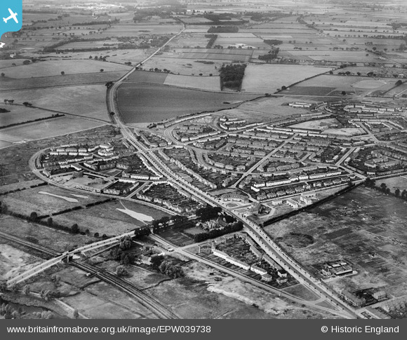
EPW039738 ENGLAND (1932). New housing estates alongside Drayton Road, Mile Cross, 1932
© Copyright OpenStreetMap contributors and licensed by the OpenStreetMap Foundation. 2026. Cartography is licensed as CC BY-SA.
Details
| Title | [EPW039738] New housing estates alongside Drayton Road, Mile Cross, 1932 |
| Reference | EPW039738 |
| Date | 23-July-1932 |
| Link | |
| Place name | MILE CROSS |
| Parish | |
| District | |
| Country | ENGLAND |
| Easting / Northing | 621531, 310500 |
| Longitude / Latitude | 1.2751048186259, 52.6465687733 |
| National Grid Reference | TG215105 |
Pins

stumcp |
Tuesday 14th of November 2017 08:02:37 AM | |

stumcp |
Tuesday 14th of November 2017 08:01:12 AM | |

stumcp |
Tuesday 14th of November 2017 08:00:31 AM | |

stumcp |
Tuesday 14th of November 2017 07:59:58 AM | |

Chris Lambert |
Sunday 12th of April 2015 05:00:37 PM | |

Chris Lambert |
Sunday 12th of April 2015 04:59:11 PM | |
I think you`ll find it`s Mile Cross Road. |

gazza1066 |
Sunday 21st of February 2016 06:34:53 PM |

Chris Lambert |
Sunday 12th of April 2015 04:58:36 PM |

