
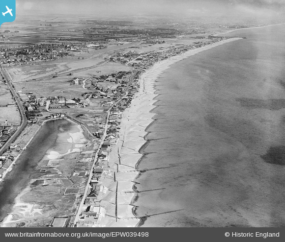
EPW039498 ENGLAND (1932). Shoreham Beach and environs, Shoreham-by-Sea, from the west, 1932
© Copyright OpenStreetMap contributors and licensed by the OpenStreetMap Foundation. 2026. Cartography is licensed as CC BY-SA.
Details
| Title | [EPW039498] Shoreham Beach and environs, Shoreham-by-Sea, from the west, 1932 |
| Reference | EPW039498 |
| Date | August-1932 |
| Link | |
| Place name | SHOREHAM-BY-SEA |
| Parish | |
| District | |
| Country | ENGLAND |
| Easting / Northing | 520498, 104195 |
| Longitude / Latitude | -0.28900304961844, 50.824178954441 |
| National Grid Reference | TQ205042 |
Pins

Alan McFaden |
Tuesday 3rd of December 2013 10:03:49 AM | |
|
Alan McFaden |
Tuesday 3rd of December 2013 10:02:22 AM | |
|
Alan McFaden |
Tuesday 3rd of December 2013 10:00:05 AM | |

micky |
Thursday 10th of January 2013 05:00:55 PM |


