
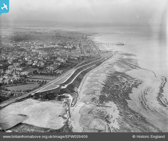
EPW039406 ENGLAND (1932). The Pound, King Edward's Parade and the town, Eastbourne, from the south-west, 1932
© Copyright OpenStreetMap contributors and licensed by the OpenStreetMap Foundation. 2025. Cartography is licensed as CC BY-SA.
Details
| Title | [EPW039406] The Pound, King Edward's Parade and the town, Eastbourne, from the south-west, 1932 |
| Reference | EPW039406 |
| Date | August-1932 |
| Link | |
| Place name | EASTBOURNE |
| Parish | |
| District | |
| Country | ENGLAND |
| Easting / Northing | 560495, 97358 |
| Longitude / Latitude | 0.27552401960411, 50.753032429288 |
| National Grid Reference | TV605974 |
Pins

Mikeo1938 |
Sunday 15th of April 2018 06:46:38 PM | |

Alan McFaden |
Wednesday 20th of November 2013 11:14:54 PM | |
|
Alan McFaden |
Wednesday 20th of November 2013 11:14:14 PM | |
|
Alan McFaden |
Wednesday 20th of November 2013 11:13:34 PM | |
|
Alan McFaden |
Wednesday 20th of November 2013 11:13:03 PM | |
|
Mikeo1938 |
Tuesday 11th of December 2012 10:26:32 PM |


