
Downtime message
Due to planned maintenance taking place on Thursday 9th October between 9:00 AM and 1:00 PM, services might be disrupted or temporarily unavailable. We apologise for any inconvenience.
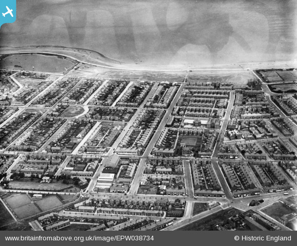
EPW038734 ENGLAND (1932). Carr Road and environs, Fleetwood, 1932. This image has been produced from a copy-negative.
© Copyright OpenStreetMap contributors and licensed by the OpenStreetMap Foundation. 2025. Cartography is licensed as CC BY-SA.
Details
| Title | [EPW038734] Carr Road and environs, Fleetwood, 1932. This image has been produced from a copy-negative. |
| Reference | EPW038734 |
| Date | June-1932 |
| Link | |
| Place name | FLEETWOOD |
| Parish | FLEETWOOD |
| District | |
| Country | ENGLAND |
| Easting / Northing | 333005, 447886 |
| Longitude / Latitude | -3.0202741341297, 53.922572365643 |
| National Grid Reference | SD330479 |
