
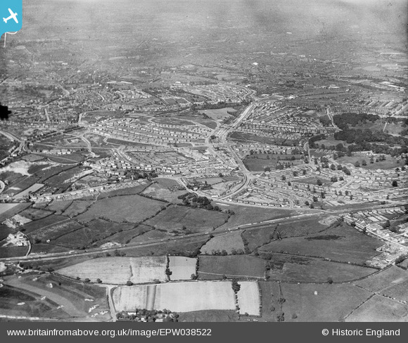
EPW038522 ENGLAND (1932). Wolverhampton Road and new housing estates surrounding Norman Road and Warley Park, Warley Woods, 1932
© Copyright OpenStreetMap contributors and licensed by the OpenStreetMap Foundation. 2026. Cartography is licensed as CC BY-SA.
Details
| Title | [EPW038522] Wolverhampton Road and new housing estates surrounding Norman Road and Warley Park, Warley Woods, 1932 |
| Reference | EPW038522 |
| Date | June-1932 |
| Link | |
| Place name | WARLEY WOODS |
| Parish | |
| District | |
| Country | ENGLAND |
| Easting / Northing | 400542, 286559 |
| Longitude / Latitude | -1.9920191524167, 52.47659005133 |
| National Grid Reference | SP005866 |
Pins

Albi65 |
Friday 24th of April 2020 08:27:22 AM | |
|
Albi65 |
Friday 24th of April 2020 08:26:18 AM | |
|
Stormy78 |
Friday 25th of July 2014 01:08:29 PM | |
|
Stormy78 |
Thursday 24th of July 2014 11:10:24 AM | |
|
Stormy78 |
Thursday 24th of July 2014 11:08:06 AM | |
|
Stormy78 |
Thursday 24th of July 2014 11:06:22 AM |