
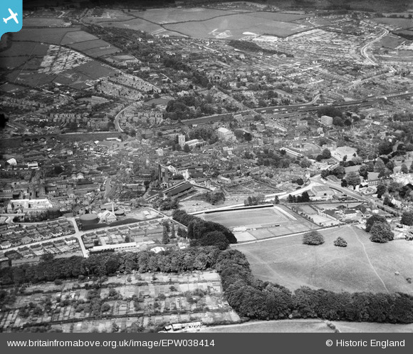
EPW038414 ENGLAND (1932). The town, Wycombe, from the south-west, 1932
© Copyright OpenStreetMap contributors and licensed by the OpenStreetMap Foundation. 2025. Cartography is licensed as CC BY-SA.
Details
| Title | [EPW038414] The town, Wycombe, from the south-west, 1932 |
| Reference | EPW038414 |
| Date | June-1932 |
| Link | |
| Place name | HIGH WYCOMBE |
| Parish | |
| District | |
| Country | ENGLAND |
| Easting / Northing | 486162, 192696 |
| Longitude / Latitude | -0.75512306691528, 51.626007155592 |
| National Grid Reference | SU862927 |
Pins
Be the first to add a comment to this image!