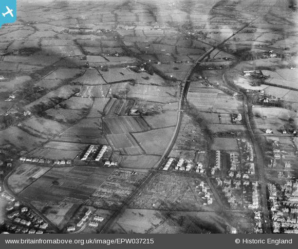
EPW037215 ENGLAND (1931). Newton Hollows and environs, Newton, 1931
© Copyright OpenStreetMap contributors and licensed by the OpenStreetMap Foundation. 2026. Cartography is licensed as CC BY-SA.
Details
| Title | [EPW037215] Newton Hollows and environs, Newton, 1931 |
| Reference | EPW037215 |
| Date | November-1931 |
| Link | |
| Place name | NEWTON |
| Parish | |
| District | |
| Country | ENGLAND |
| Easting / Northing | 341927, 368019 |
| Longitude / Latitude | -2.8695684753522, 53.205780297793 |
| National Grid Reference | SJ419680 |
Pins
 [eBay} - Copy_0.jpg)
ChesterMan |
Wednesday 6th of March 2024 04:34:52 PM | |
 [eBay} - Copy_0.jpg)
ChesterMan |
Wednesday 6th of March 2024 04:30:09 PM | |
 [eBay} - Copy_0.jpg)
ChesterMan |
Wednesday 6th of March 2024 04:10:47 PM | |
 [eBay} - Copy_0.jpg)
ChesterMan |
Wednesday 6th of March 2024 03:30:28 PM | |
 [eBay} - Copy_0.jpg)
ChesterMan |
Wednesday 6th of March 2024 03:07:28 PM | |
 [eBay} - Copy_0.jpg)
ChesterMan |
Wednesday 6th of March 2024 03:02:06 PM | |
 [eBay} - Copy_0.jpg)
ChesterMan |
Wednesday 6th of March 2024 02:56:11 PM | |
 [eBay} - Copy_0.jpg)
ChesterMan |
Wednesday 6th of March 2024 02:48:05 PM | |
 [eBay} - Copy_0.jpg)
ChesterMan |
Wednesday 6th of March 2024 02:36:05 PM | |
 [eBay} - Copy_0.jpg)
ChesterMan |
Wednesday 6th of March 2024 02:29:05 PM | |
 [eBay} - Copy_0.jpg)
ChesterMan |
Wednesday 6th of March 2024 02:28:04 PM | |
 [eBay} - Copy_0.jpg)
ChesterMan |
Wednesday 6th of March 2024 02:23:19 PM | |
 [eBay} - Copy_0.jpg)
ChesterMan |
Wednesday 6th of March 2024 02:06:55 PM | |
 [eBay} - Copy_0.jpg)
ChesterMan |
Wednesday 6th of March 2024 02:05:21 PM | |
 [eBay} - Copy_0.jpg)
ChesterMan |
Wednesday 6th of March 2024 02:04:31 PM | |
 [eBay} - Copy_0.jpg)
ChesterMan |
Wednesday 6th of March 2024 02:02:55 PM | |
 [eBay} - Copy_0.jpg)
ChesterMan |
Wednesday 6th of March 2024 02:02:06 PM | |

dd |
Friday 14th of April 2023 10:01:42 AM | |

dd |
Friday 14th of April 2023 10:00:50 AM | |

dd |
Friday 14th of April 2023 10:00:25 AM | |

staffsmod |
Friday 4th of October 2013 02:15:29 PM | |

old parkonian |
Wednesday 11th of September 2013 10:29:11 AM | |

Bunn72 |
Friday 6th of September 2013 08:46:52 PM | |

Bunn72 |
Friday 6th of September 2013 08:45:48 PM | |

Bunn72 |
Wednesday 22nd of May 2013 12:30:01 PM | |

Bunn72 |
Wednesday 22nd of May 2013 12:28:51 PM | |

Bunn72 |
Wednesday 22nd of May 2013 12:28:28 PM | |

Bunn72 |
Saturday 18th of May 2013 08:13:49 PM | |

Bunn72 |
Saturday 18th of May 2013 08:12:30 PM | |

Bunn72 |
Saturday 18th of May 2013 08:10:16 PM | |

Bunn72 |
Saturday 18th of May 2013 08:09:54 PM | |

Bunn72 |
Saturday 18th of May 2013 08:09:20 PM |

