
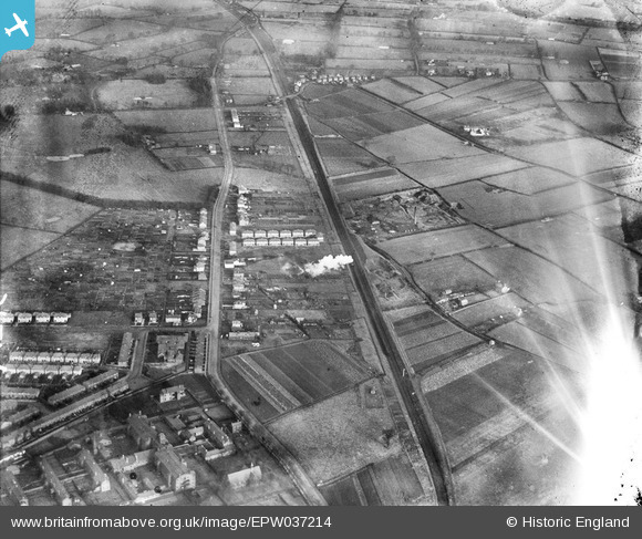
EPW037214 ENGLAND (1931). Hoole Lane, Myrtle Grove and environs, Hoole, 1931
© Copyright OpenStreetMap contributors and licensed by the OpenStreetMap Foundation. 2026. Cartography is licensed as CC BY-SA.
Details
| Title | [EPW037214] Hoole Lane, Myrtle Grove and environs, Hoole, 1931 |
| Reference | EPW037214 |
| Date | November-1931 |
| Link | |
| Place name | HOOLE |
| Parish | |
| District | |
| Country | ENGLAND |
| Easting / Northing | 342525, 367214 |
| Longitude / Latitude | -2.8604703562605, 53.198609234017 |
| National Grid Reference | SJ425672 |
Pins

tim birch |
Sunday 12th of February 2023 05:08:26 PM | |
|
knowhowe |
Monday 14th of July 2014 11:55:56 PM | |
|
Peter D |
Friday 25th of April 2014 10:55:44 PM | |
|
Peter D |
Friday 25th of April 2014 10:49:19 PM | |
|
Peter D |
Friday 25th of April 2014 10:47:03 PM | |
|
Peter D |
Friday 25th of April 2014 10:39:53 PM | |
|
Peter D |
Friday 25th of April 2014 10:37:50 PM | |
|
Tez Lopez |
Friday 14th of June 2013 09:43:39 AM | |
|
Tez Lopez |
Friday 14th of June 2013 09:28:29 AM | |
|
Tez Lopez |
Friday 14th of June 2013 09:27:08 AM | |
|
Tez Lopez |
Friday 14th of June 2013 09:25:52 AM |