
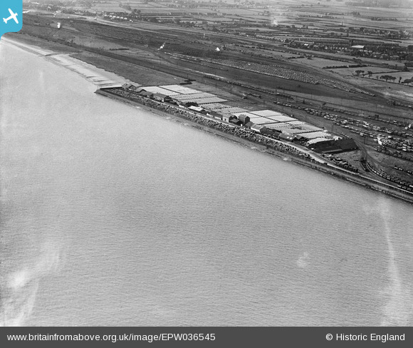
EPW036545 ENGLAND (1931). Fish suring sheds, Gipsyville, 1931
© Copyright OpenStreetMap contributors and licensed by the OpenStreetMap Foundation. 2025. Cartography is licensed as CC BY-SA.
Details
| Title | [EPW036545] Fish suring sheds, Gipsyville, 1931 |
| Reference | EPW036545 |
| Date | August-1931 |
| Link | |
| Place name | GIPSYVILLE |
| Parish | |
| District | |
| Country | ENGLAND |
| Easting / Northing | 506179, 426317 |
| Longitude / Latitude | -0.39064701804578, 53.722215637393 |
| National Grid Reference | TA062263 |
Pins

John Wass |
Tuesday 23rd of September 2014 03:56:46 PM |