
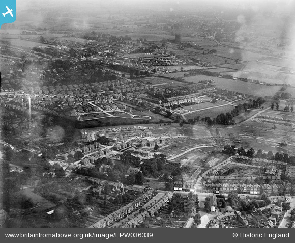
EPW036339 ENGLAND (1931). New housing development at Forest Approach and environs, Woodford, from the south-west, 1931
© Copyright OpenStreetMap contributors and licensed by the OpenStreetMap Foundation. 2026. Cartography is licensed as CC BY-SA.
Details
| Title | [EPW036339] New housing development at Forest Approach and environs, Woodford, from the south-west, 1931 |
| Reference | EPW036339 |
| Date | August-1931 |
| Link | |
| Place name | WOODFORD |
| Parish | |
| District | |
| Country | ENGLAND |
| Easting / Northing | 539998, 191152 |
| Longitude / Latitude | 0.021666529502221, 51.60131278431 |
| National Grid Reference | TQ400912 |
Pins

Mikeya |
Tuesday 30th of June 2020 08:01:57 PM | |
|
Denise |
Tuesday 14th of March 2017 09:32:47 PM | |
|
Denise |
Tuesday 14th of March 2017 08:50:24 PM | |
|
Denise |
Tuesday 14th of March 2017 08:48:01 PM | |
|
Denise |
Tuesday 14th of March 2017 08:47:56 PM |