
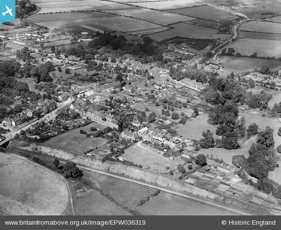
EPW036319 ENGLAND (1931). The town, Wendover, from the south-west, 1931
© Copyright OpenStreetMap contributors and licensed by the OpenStreetMap Foundation. 2025. Cartography is licensed as CC BY-SA.
Details
| Title | [EPW036319] The town, Wendover, from the south-west, 1931 |
| Reference | EPW036319 |
| Date | August-1931 |
| Link | |
| Place name | WENDOVER |
| Parish | WENDOVER |
| District | |
| Country | ENGLAND |
| Easting / Northing | 486776, 207563 |
| Longitude / Latitude | -0.74255542961733, 51.759567853321 |
| National Grid Reference | SP868076 |
