
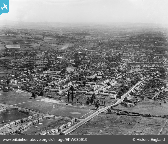
EPW035919 ENGLAND (1931). South Road and the town, Stourbridge, from the west, 1931
© Copyright OpenStreetMap contributors and licensed by the OpenStreetMap Foundation. 2026. Cartography is licensed as CC BY-SA.
Details
| Title | [EPW035919] South Road and the town, Stourbridge, from the west, 1931 |
| Reference | EPW035919 |
| Date | July-1931 |
| Link | |
| Place name | STOURBRIDGE |
| Parish | |
| District | |
| Country | ENGLAND |
| Easting / Northing | 389029, 283954 |
| Longitude / Latitude | -2.1614598384105, 52.453058490468 |
| National Grid Reference | SO890840 |
Pins
 This may be St Michael's and all Angels Church. I recognise the bowed back of the church where the Altar was. It's on the corner of South Road and Heath Farm Road. Opposite was the Gig Mill Methodist Church This may be St Michael's and all Angels Church. I recognise the bowed back of the church where the Altar was. It's on the corner of South Road and Heath Farm Road. Opposite was the Gig Mill Methodist Church |

Rosemarie |
Tuesday 25th of August 2026 10:36:25 PM |
| Heathfield House. Now demolished to make way for about 40 new houses! |
DaveS |
Tuesday 10th of January 2017 03:31:35 PM |