
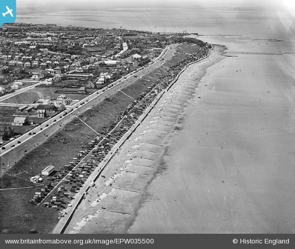
EPW035500 ENGLAND (1931). Tankerton Slopes and the town, Whitstable, from the north-east, 1931
© Copyright OpenStreetMap contributors and licensed by the OpenStreetMap Foundation. 2026. Cartography is licensed as CC BY-SA.
Details
| Title | [EPW035500] Tankerton Slopes and the town, Whitstable, from the north-east, 1931 |
| Reference | EPW035500 |
| Date | May-1931 |
| Link | |
| Place name | WHITSTABLE |
| Parish | |
| District | |
| Country | ENGLAND |
| Easting / Northing | 612462, 167367 |
| Longitude / Latitude | 1.0524568022507, 51.365063680224 |
| National Grid Reference | TR125674 |
Pins

Sparky |
Tuesday 24th of October 2017 07:58:22 AM | |
|
Sparky |
Sunday 13th of August 2017 12:20:52 PM | |
|
Sparky |
Sunday 13th of August 2017 12:19:41 PM | |
|
Sparky |
Sunday 13th of August 2017 12:18:31 PM | |
|
Sparky |
Sunday 13th of August 2017 12:18:04 PM | |
|
Sparky |
Sunday 13th of August 2017 12:17:26 PM | |
|
Sparky |
Sunday 13th of August 2017 12:16:09 PM | |
|
Sparky |
Sunday 13th of August 2017 12:15:08 PM | |
|
Sparky |
Sunday 13th of August 2017 12:14:07 PM |