
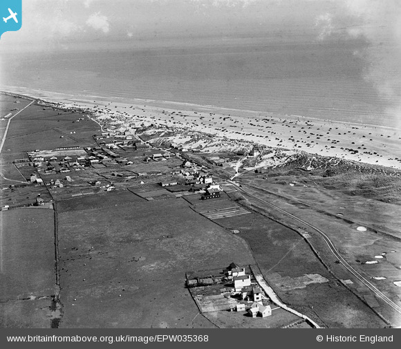
EPW035368 ENGLAND (1931). The village and Camber Sands, Camber, from the north-west, 1931
© Copyright OpenStreetMap contributors and licensed by the OpenStreetMap Foundation. 2025. Cartography is licensed as CC BY-SA.
Details
| Title | [EPW035368] The village and Camber Sands, Camber, from the north-west, 1931 |
| Reference | EPW035368 |
| Date | 25-May-1931 |
| Link | |
| Place name | CAMBER |
| Parish | CAMBER |
| District | |
| Country | ENGLAND |
| Easting / Northing | 596117, 118932 |
| Longitude / Latitude | 0.79154922624544, 50.935887690129 |
| National Grid Reference | TQ961189 |
Pins

Class31 |
Tuesday 29th of January 2013 12:08:15 PM | |
That is not the tramway, that is just the road, from Camber to East Guldeford. If you follow it into Camber, you will see the motor vehicles on it, close to what is now the central car park. |

DavidCamber |
Tuesday 5th of November 2013 09:35:53 PM |