
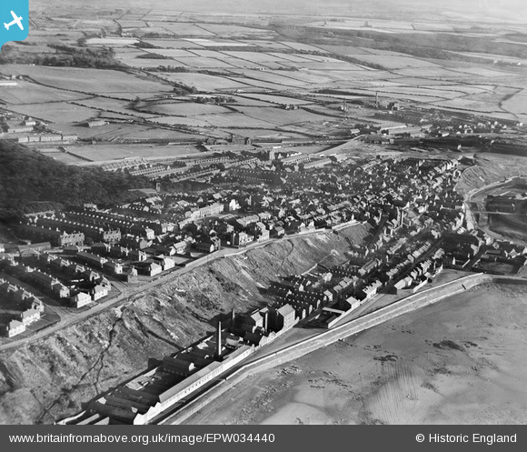
EPW034440 ENGLAND (1930). The town, Maryport, from the north-west, 1930
© Copyright OpenStreetMap contributors and licensed by the OpenStreetMap Foundation. 2026. Cartography is licensed as CC BY-SA.
Details
| Title | [EPW034440] The town, Maryport, from the north-west, 1930 |
| Reference | EPW034440 |
| Date | August-1930 |
| Link | |
| Place name | MARYPORT |
| Parish | MARYPORT |
| District | |
| Country | ENGLAND |
| Easting / Northing | 303587, 537035 |
| Longitude / Latitude | -3.4969517091786, 54.718955404822 |
| National Grid Reference | NY036370 |
Pins

Waldemar |
Tuesday 6th of October 2020 01:29:15 PM | |
|
Waldemar |
Tuesday 6th of October 2020 01:26:27 PM | |
|
Waldemar |
Tuesday 6th of October 2020 01:24:59 PM | |
|
Waldemar |
Tuesday 6th of October 2020 01:23:50 PM | |
|
Waldemar |
Tuesday 6th of October 2020 01:23:17 PM | |
|
Waldemar |
Tuesday 6th of October 2020 01:22:40 PM | |
|
Waldemar |
Tuesday 6th of October 2020 01:21:20 PM | |
|
Waldemar |
Tuesday 6th of October 2020 01:20:50 PM | |
|
Waldemar |
Tuesday 6th of October 2020 01:18:48 PM | |
|
Waldemar |
Tuesday 6th of October 2020 01:17:36 PM | |
|
RichardG |
Thursday 28th of June 2018 04:48:50 PM |