
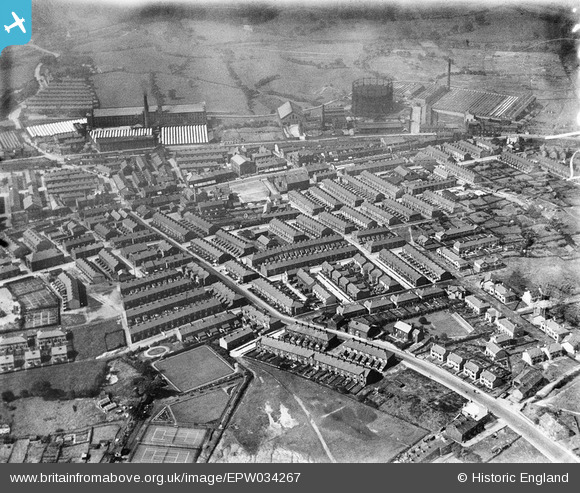
EPW034267 ENGLAND (1930). The town centre, Brierfield, 1930
© Copyright OpenStreetMap contributors and licensed by the OpenStreetMap Foundation. 2026. Cartography is licensed as CC BY-SA.
Details
| Title | [EPW034267] The town centre, Brierfield, 1930 |
| Reference | EPW034267 |
| Date | July-1930 |
| Link | |
| Place name | BRIERFIELD |
| Parish | BRIERFIELD |
| District | |
| Country | ENGLAND |
| Easting / Northing | 384843, 436498 |
| Longitude / Latitude | -2.2302836707048, 53.824319507109 |
| National Grid Reference | SD848365 |
Pins

The Local Historian |
Sunday 22nd of December 2019 05:44:25 PM | |

powerpop |
Monday 16th of July 2018 10:39:22 PM | |
|
powerpop |
Monday 16th of July 2018 10:36:56 PM | |
|
powerpop |
Monday 16th of July 2018 10:36:33 PM | |
|
wadey |
Monday 6th of October 2014 07:55:50 PM | |
|
wadey |
Monday 6th of October 2014 07:55:18 PM | |
|
wadey |
Monday 6th of October 2014 07:53:47 PM |