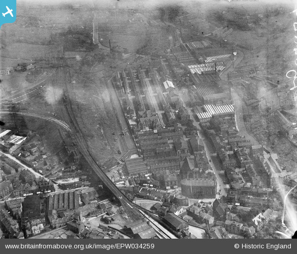
EPW034259 ENGLAND (1930). Cambridge Street and environs, Todmorden, 1930
© Copyright OpenStreetMap contributors and licensed by the OpenStreetMap Foundation. 2026. Cartography is licensed as CC BY-SA.
Details
| Title | [EPW034259] Cambridge Street and environs, Todmorden, 1930 |
| Reference | EPW034259 |
| Date | July-1930 |
| Link | |
| Place name | TODMORDEN |
| Parish | TODMORDEN |
| District | |
| Country | ENGLAND |
| Easting / Northing | 393877, 424248 |
| Longitude / Latitude | -2.0927853233284, 53.714388663187 |
| National Grid Reference | SD939242 |
Pins

wadey |
Sunday 9th of April 2023 10:28:46 AM | |

wadey |
Sunday 9th of April 2023 10:14:42 AM | |

wadey |
Sunday 9th of April 2023 10:13:59 AM | |

wadey |
Sunday 9th of April 2023 10:06:20 AM | |

wadey |
Sunday 9th of April 2023 10:02:51 AM | |

wadey |
Sunday 9th of April 2023 10:01:46 AM | |

Keith Wallace |
Monday 17th of August 2015 08:47:07 AM | |

Keith Wallace |
Monday 17th of August 2015 08:46:29 AM | |

wadey |
Wednesday 3rd of December 2014 02:27:29 PM | |

wadey |
Wednesday 3rd of December 2014 02:26:39 PM | |

wadey |
Saturday 8th of November 2014 01:34:43 PM | |

wadey |
Saturday 8th of November 2014 01:34:16 PM | |

wadey |
Saturday 8th of November 2014 01:33:31 PM | |

wadey |
Saturday 8th of November 2014 01:32:59 PM | |

wadey |
Saturday 8th of November 2014 01:32:43 PM | |

wadey |
Saturday 8th of November 2014 01:32:18 PM |

