
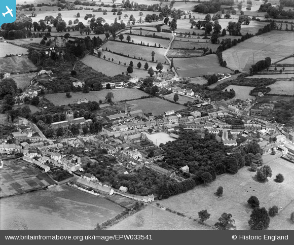
EPW033541 ENGLAND (1930). East Street and environs, Crediton, 1930
© Copyright OpenStreetMap contributors and licensed by the OpenStreetMap Foundation. 2026. Cartography is licensed as CC BY-SA.
Details
| Title | [EPW033541] East Street and environs, Crediton, 1930 |
| Reference | EPW033541 |
| Date | July-1930 |
| Link | |
| Place name | CREDITON |
| Parish | CREDITON |
| District | |
| Country | ENGLAND |
| Easting / Northing | 283779, 100188 |
| Longitude / Latitude | -3.6490246537224, 50.789031202354 |
| National Grid Reference | SS838002 |
Pins
Be the first to add a comment to this image!
User Comment Contributions
The row of white cottages behind East Street was Underhill Court. My father was born there in 1916. The cottages have since been demolished. The empty field behind is now occupied by a Morrisons supermarket. |

ravello80 |
Thursday 5th of September 2013 08:52:01 PM |