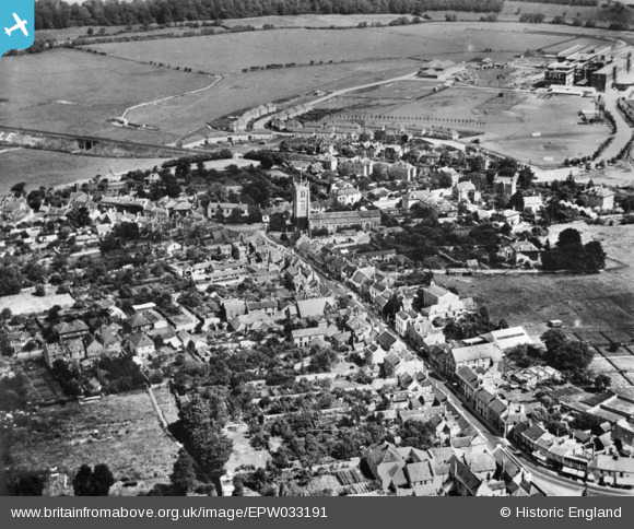
EPW033191 ENGLAND (1930). St John the Baptist's Church and the High Street, Keynsham, 1930. This image has been produced from a copy-negative.
© Copyright OpenStreetMap contributors and licensed by the OpenStreetMap Foundation. 2025. Cartography is licensed as CC BY-SA.
Details
| Title | [EPW033191] St John the Baptist's Church and the High Street, Keynsham, 1930. This image has been produced from a copy-negative. |
| Reference | EPW033191 |
| Date | July-1930 |
| Link | |
| Place name | KEYNSHAM |
| Parish | KEYNSHAM |
| District | |
| Country | ENGLAND |
| Easting / Northing | 365405, 168771 |
| Longitude / Latitude | -2.4975350876458, 51.416405694532 |
| National Grid Reference | ST654688 |
Pins
User Comment Contributions
St. John the Baptist's Church, Keynsham, 06/06/2015 |
 Class31 |
Tuesday 9th of June 2015 02:01:26 PM |

