
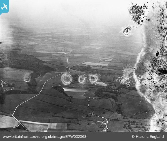
EPW032363 ENGLAND (1930). Ruins Plantation, Coombe Hill and surrounding countryside, Hilton, from the north-west, 1930. This image has been produced from a damaged negative.
© Copyright OpenStreetMap contributors and licensed by the OpenStreetMap Foundation. 2026. Cartography is licensed as CC BY-SA.
Details
| Title | [EPW032363] Ruins Plantation, Coombe Hill and surrounding countryside, Hilton, from the north-west, 1930. This image has been produced from a damaged negative. |
| Reference | EPW032363 |
| Date | June-1930 |
| Link | |
| Place name | HILTON |
| Parish | HILTON |
| District | |
| Country | ENGLAND |
| Easting / Northing | 377357, 102555 |
| Longitude / Latitude | -2.3214891305599, 50.821532093483 |
| National Grid Reference | ST774026 |
Pins
Be the first to add a comment to this image!