
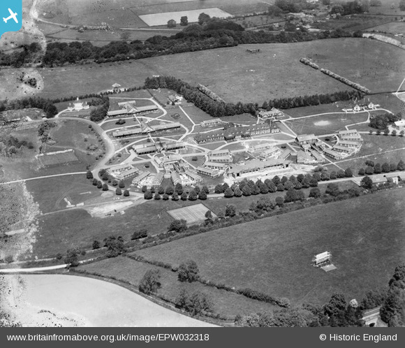
EPW032318 ENGLAND (1930). The Treloar Cripples' Home, Alton, 1930
© Copyright OpenStreetMap contributors and licensed by the OpenStreetMap Foundation. 2026. Cartography is licensed as CC BY-SA.
Details
| Title | [EPW032318] The Treloar Cripples' Home, Alton, 1930 |
| Reference | EPW032318 |
| Date | June-1930 |
| Link | |
| Place name | ALTON |
| Parish | ALTON |
| District | |
| Country | ENGLAND |
| Easting / Northing | 470559, 138269 |
| Longitude / Latitude | -0.99133039792416, 51.138812426603 |
| National Grid Reference | SU706383 |
Pins

Ferrers |
Monday 5th of October 2020 05:09:04 PM | |

Memory Lane |
Thursday 7th of March 2013 03:35:39 PM |