
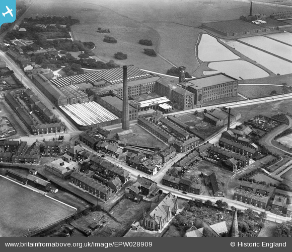
EPW028909 ENGLAND (1929). The Hurst Cotton Mills and Higher Hurst, Ashton-under-Lyne, 1929
© Copyright OpenStreetMap contributors and licensed by the OpenStreetMap Foundation. 2026. Cartography is licensed as CC BY-SA.
Details
| Title | [EPW028909] The Hurst Cotton Mills and Higher Hurst, Ashton-under-Lyne, 1929 |
| Reference | EPW028909 |
| Date | August-1929 |
| Link | |
| Place name | ASHTON-UNDER-LYNE |
| Parish | |
| District | |
| Country | ENGLAND |
| Easting / Northing | 394912, 400346 |
| Longitude / Latitude | -2.0767110364496, 53.499537715528 |
| National Grid Reference | SD949003 |
Pins

jams39 |
Friday 26th of November 2021 11:33:09 AM | |
|
jams39 |
Friday 26th of November 2021 11:31:24 AM | |
|
TheBlueCube |
Tuesday 28th of October 2014 08:23:15 PM | |
|
TheBlueCube |
Tuesday 28th of October 2014 08:21:15 PM | |
|
TheBlueCube |
Sunday 27th of July 2014 09:34:47 PM | |
|
TheBlueCube |
Sunday 27th of July 2014 09:33:32 PM | |
|
TheBlueCube |
Sunday 27th of July 2014 09:25:07 PM | |
|
stardelta |
Saturday 14th of June 2014 06:15:10 PM | |
|
stardelta |
Saturday 14th of June 2014 06:12:49 PM | |
|
stardelta |
Saturday 14th of June 2014 06:11:04 PM | |
|
stardelta |
Saturday 14th of June 2014 06:10:01 PM | |
|
stardelta |
Saturday 14th of June 2014 06:06:05 PM | |
|
stardelta |
Saturday 14th of June 2014 06:04:32 PM |