
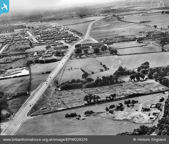
EPW028226 ENGLAND (1929). The A2 Dartford Bypass (Princes Road), Dartford, from the north-east, 1929
© Copyright OpenStreetMap contributors and licensed by the OpenStreetMap Foundation. 2026. Cartography is licensed as CC BY-SA.
Details
| Title | [EPW028226] The A2 Dartford Bypass (Princes Road), Dartford, from the north-east, 1929 |
| Reference | EPW028226 |
| Date | 10-August-1929 |
| Link | |
| Place name | DARTFORD |
| Parish | |
| District | |
| Country | ENGLAND |
| Easting / Northing | 554766, 173411 |
| Longitude / Latitude | 0.22696831016053, 51.438033397717 |
| National Grid Reference | TQ548734 |
Pins

NigelS |
Friday 29th of October 2021 06:21:38 AM | |
|
Mike Floate |
Thursday 8th of January 2015 08:50:57 AM |