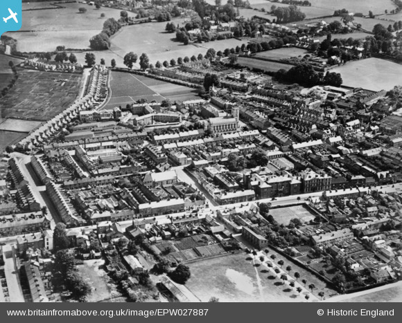
EPW027887 ENGLAND (1929). East Reach, Holy Trinity Church and environs, Taunton, 1929. This image has been produced from a copy-negative.
© Copyright OpenStreetMap contributors and licensed by the OpenStreetMap Foundation. 2026. Cartography is licensed as CC BY-SA.
Details
| Title | [EPW027887] East Reach, Holy Trinity Church and environs, Taunton, 1929. This image has been produced from a copy-negative. |
| Reference | EPW027887 |
| Date | 28-June-1929 |
| Link | |
| Place name | TAUNTON |
| Parish | |
| District | |
| Country | ENGLAND |
| Easting / Northing | 323573, 124513 |
| Longitude / Latitude | -3.0896301117502, 51.014371555448 |
| National Grid Reference | ST236245 |
Pins

Mon |
Friday 1st of November 2019 09:59:47 AM | |

gBr |
Friday 22nd of January 2016 09:45:01 PM | |

gBr |
Friday 22nd of January 2016 09:30:02 PM | |

gBr |
Friday 22nd of January 2016 09:28:07 PM | |

gBr |
Friday 22nd of January 2016 09:27:18 PM |

