
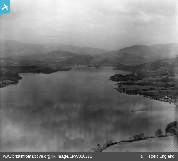
EPW026771 ENGLAND (1929). Lake Windermere, Windermere, from the south-east, 1929
© Copyright OpenStreetMap contributors and licensed by the OpenStreetMap Foundation. 2025. Cartography is licensed as CC BY-SA.
Details
| Title | [EPW026771] Lake Windermere, Windermere, from the south-east, 1929 |
| Reference | EPW026771 |
| Date | 16-May-1929 |
| Link | |
| Place name | WINDERMERE |
| Parish | WINDERMERE |
| District | |
| Country | ENGLAND |
| Easting / Northing | 339820, 498751 |
| Longitude / Latitude | -2.9266578619582, 54.380549105046 |
| National Grid Reference | SD398988 |
Pins
 Class31 |
Saturday 22nd of June 2013 03:37:55 PM |

User Comment Contributions
 Windermere looking north 21/08/2007 |
Class31 |
Thursday 29th of May 2014 08:25:52 AM |