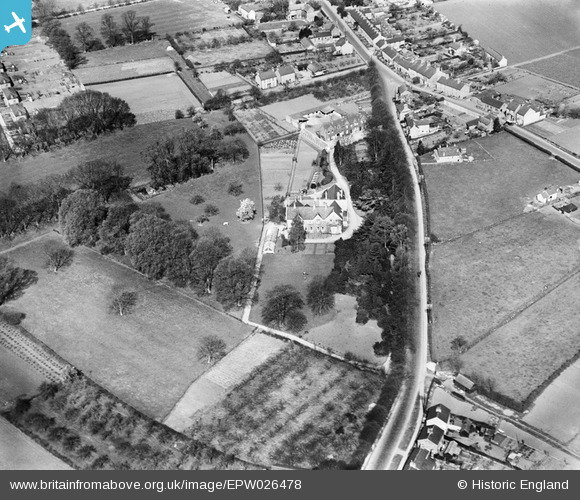
EPW026478 ENGLAND (1929). Digswell House on the Hitchin Road, Shefford, 1929
© Copyright OpenStreetMap contributors and licensed by the OpenStreetMap Foundation. 2024. Cartography is licensed as CC BY-SA.
Details
| Title | [EPW026478] Digswell House on the Hitchin Road, Shefford, 1929 |
| Reference | EPW026478 |
| Date | May-1929 |
| Link | |
| Place name | SHEFFORD |
| Parish | SHEFFORD |
| District | |
| Country | ENGLAND |
| Easting / Northing | 514906, 238806 |
| Longitude / Latitude | -0.32468132997664, 52.03531651264 |
| National Grid Reference | TL149388 |
Pins
 stephen dearman |
Tuesday 13th of January 2015 11:34:32 PM | |
 Mary |
Friday 28th of November 2014 08:20:44 PM | |
it was for a long time |
 Deleted User |
Monday 8th of December 2014 02:33:58 PM |

