
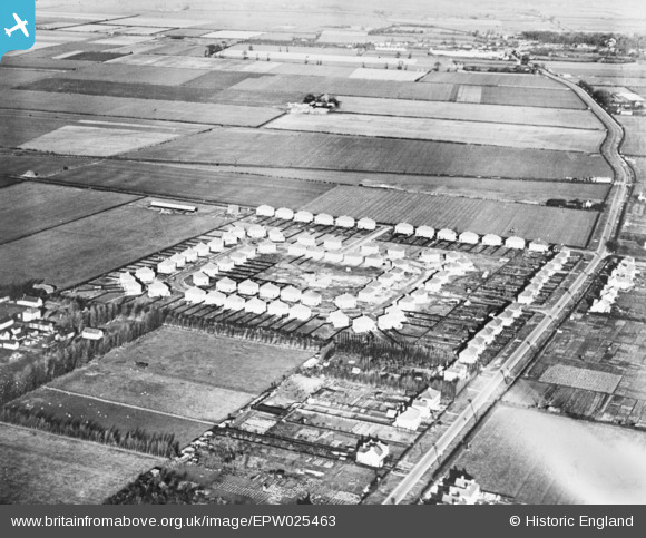
EPW025463 ENGLAND (1928). Housing surrounding Ramsden Square, Kings Hedges, 1928. This image has been produced from a copy-negative.
© Copyright OpenStreetMap contributors and licensed by the OpenStreetMap Foundation. 2026. Cartography is licensed as CC BY-SA.
Details
| Title | [EPW025463] Housing surrounding Ramsden Square, Kings Hedges, 1928. This image has been produced from a copy-negative. |
| Reference | EPW025463 |
| Date | 14-November-1928 |
| Link | |
| Place name | KINGS HEDGES |
| Parish | |
| District | |
| Country | ENGLAND |
| Easting / Northing | 546409, 261014 |
| Longitude / Latitude | 0.14388145605487, 52.227438685941 |
| National Grid Reference | TL464610 |
Pins

Matt Aldred edob.mattaldred.com |
Sunday 26th of April 2020 02:56:28 PM | |
|
Matt Aldred edob.mattaldred.com |
Sunday 26th of April 2020 02:54:22 PM | |
|
Matt Aldred edob.mattaldred.com |
Sunday 26th of April 2020 02:54:11 PM |