
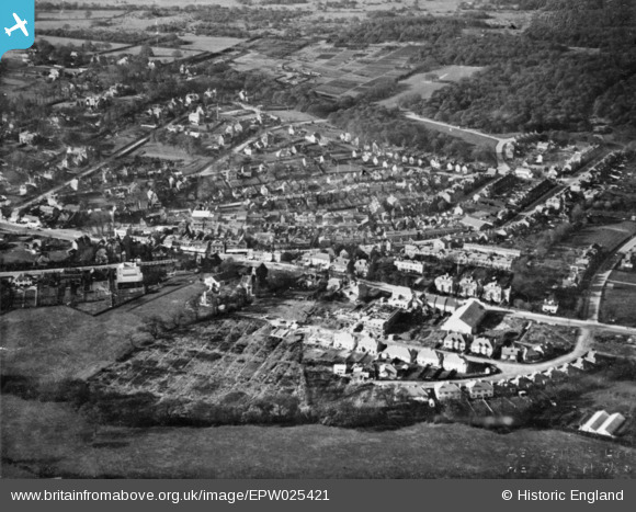
EPW025421 ENGLAND (1928). Houses around High Beech Road and Connaught Hill, Loughton, 1928. This image has been produced from a copy-negative.
© Copyright OpenStreetMap contributors and licensed by the OpenStreetMap Foundation. 2026. Cartography is licensed as CC BY-SA.
Details
| Title | [EPW025421] Houses around High Beech Road and Connaught Hill, Loughton, 1928. This image has been produced from a copy-negative. |
| Reference | EPW025421 |
| Date | 8-November-1928 |
| Link | |
| Place name | LOUGHTON |
| Parish | LOUGHTON |
| District | |
| Country | ENGLAND |
| Easting / Northing | 542044, 196192 |
| Longitude / Latitude | 0.053236030686215, 51.646092592863 |
| National Grid Reference | TQ420962 |
Pins

somoody |
Tuesday 20th of May 2025 03:45:35 PM | |
|
somoody |
Tuesday 20th of May 2025 03:44:31 PM | |
|
somoody |
Tuesday 20th of May 2025 03:43:15 PM | |
|
somoody |
Tuesday 20th of May 2025 03:42:12 PM | |

Catherine Jeater |
Tuesday 3rd of September 2019 05:15:21 PM | |
|
Catherine Jeater |
Tuesday 3rd of September 2019 05:13:58 PM | |
|
Catherine Jeater |
Tuesday 3rd of September 2019 05:13:35 PM | |
|
Finder |
Friday 24th of March 2017 11:40:31 AM | |
|
Finder |
Friday 24th of March 2017 11:39:39 AM |