
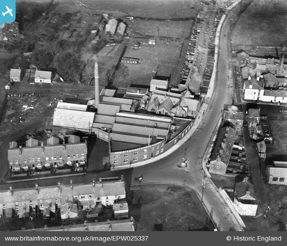
EPW025337 ENGLAND (1928). Chorley and District Hygienic Laundry, Chorley, 1928
© Copyright OpenStreetMap contributors and licensed by the OpenStreetMap Foundation. 2024. Cartography is licensed as CC BY-SA.
Nearby Images (6)
EPW025337

EPW025334

EPW025336

EPW025338

EPW025335

EPW025339

Details
| Title | [EPW025337] Chorley and District Hygienic Laundry, Chorley, 1928 |
| Reference | EPW025337 |
| Date | November-1928 |
| Link | |
| Place name | CHORLEY |
| Parish | |
| District | |
| Country | ENGLAND |
| Easting / Northing | 359179, 418563 |
| Longitude / Latitude | -2.6178161029829, 53.661727430433 |
| National Grid Reference | SD592186 |
Pins
Be the first to add a comment to this image!