
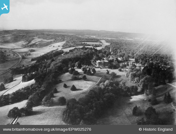
EPW025276 ENGLAND (1928). Denbies, Ranmore Common, from the east, 1928. This image has been produced from a copy-negative affected by flare.
© Copyright OpenStreetMap contributors and licensed by the OpenStreetMap Foundation. 2026. Cartography is licensed as CC BY-SA.
Details
| Title | [EPW025276] Denbies, Ranmore Common, from the east, 1928. This image has been produced from a copy-negative affected by flare. |
| Reference | EPW025276 |
| Date | October-1928 |
| Link | |
| Place name | RANMORE COMMON |
| Parish | WOTTON |
| District | |
| Country | ENGLAND |
| Easting / Northing | 515371, 150408 |
| Longitude / Latitude | -0.34705410303381, 51.24065592857 |
| National Grid Reference | TQ154504 |
Pins
Be the first to add a comment to this image!