
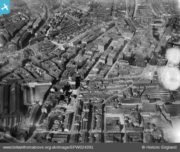
EPW024391 ENGLAND (1928). Chapel Street and environs, Bradford, 1928
© Copyright OpenStreetMap contributors and licensed by the OpenStreetMap Foundation. 2026. Cartography is licensed as CC BY-SA.
Details
| Title | [EPW024391] Chapel Street and environs, Bradford, 1928 |
| Reference | EPW024391 |
| Date | September-1928 |
| Link | |
| Place name | BRADFORD |
| Parish | |
| District | |
| Country | ENGLAND |
| Easting / Northing | 416835, 433075 |
| Longitude / Latitude | -1.7444095991664, 53.793498833346 |
| National Grid Reference | SE168331 |
Pins
 Temperance Hall (formerly Jowett Hall) - burned down 1935 and rebuilt 1937 as Bradford Civic Playhouse Temperance Hall (formerly Jowett Hall) - burned down 1935 and rebuilt 1937 as Bradford Civic Playhouse |

Lauren Fleming |
Friday 17th of July 2026 03:35:02 PM |
| Hargreaves Paints Leeds Road Great company and quality paints in the 1960/70s. |
Wobblybob |
Saturday 20th of October 2018 09:35:41 PM |