
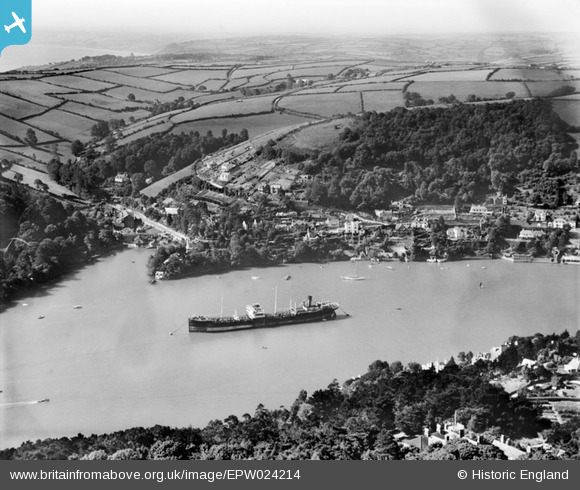
EPW024214 ENGLAND (1928). A ship at anchor on the River Dart between Warfleet and Kingswear, Warfleet, 1928
© Copyright OpenStreetMap contributors and licensed by the OpenStreetMap Foundation. 2026. Cartography is licensed as CC BY-SA.
Details
| Title | [EPW024214] A ship at anchor on the River Dart between Warfleet and Kingswear, Warfleet, 1928 |
| Reference | EPW024214 |
| Date | September-1928 |
| Link | |
| Place name | WARFLEET |
| Parish | DARTMOUTH |
| District | |
| Country | ENGLAND |
| Easting / Northing | 288210, 50638 |
| Longitude / Latitude | -3.5712910547848, 50.344422175162 |
| National Grid Reference | SX882506 |
Pins

MB |
Sunday 7th of October 2012 10:05:08 AM | |
|
MB |
Sunday 7th of October 2012 10:04:01 AM | |
|
MB |
Sunday 7th of October 2012 10:03:35 AM | |
|
MB |
Sunday 7th of October 2012 10:02:36 AM | |
|
MB |
Sunday 7th of October 2012 10:02:15 AM | |
|
MB |
Sunday 7th of October 2012 09:58:13 AM |
User Comment Contributions
Warfleet Mill became the home of Dartmouth Pottery from 1948-2002. Dartmouth Pottery originally had a bottle kiln, but soon replaced it with a gas kiln. The Pottery became famous for its Polka Dot Ware - a blue with white spots dinner and tea service inspired by a dress worn by Princess Margaret. Dartmouth also made Gurgling Fish jugs - water jugs in the shape of a fish, which gurgled when water was poured out. |
MattFilm |
Wednesday 10th of April 2013 09:45:09 PM |