
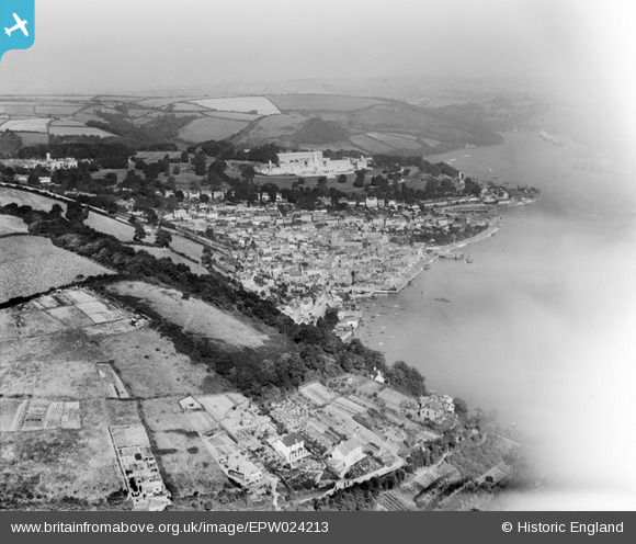
EPW024213 ENGLAND (1928). The town, Britannia Royal Naval College and surrounding countryside, Dartmouth, from the south-east, 1928
© Copyright OpenStreetMap contributors and licensed by the OpenStreetMap Foundation. 2025. Cartography is licensed as CC BY-SA.
Details
| Title | [EPW024213] The town, Britannia Royal Naval College and surrounding countryside, Dartmouth, from the south-east, 1928 |
| Reference | EPW024213 |
| Date | September-1928 |
| Link | |
| Place name | DARTMOUTH |
| Parish | DARTMOUTH |
| District | |
| Country | ENGLAND |
| Easting / Northing | 287844, 50843 |
| Longitude / Latitude | -3.5764944204082, 50.346195696226 |
| National Grid Reference | SX878508 |
Pins
Be the first to add a comment to this image!
User Comment Contributions
Having looked at this image,Iam more convinced that the image EPW023971 is that of the Dart,the ships and the house by the river in the distance (top right) do appear to be similar?? |

dawlishbob |
Saturday 14th of July 2012 01:02:05 PM |