
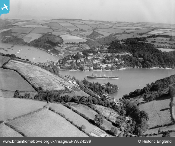
EPW024189 ENGLAND (1928). A ship at anchor on the River Dart between Warfleet and Kingswear, Warfleet, 1928
© Copyright OpenStreetMap contributors and licensed by the OpenStreetMap Foundation. 2026. Cartography is licensed as CC BY-SA.
Details
| Title | [EPW024189] A ship at anchor on the River Dart between Warfleet and Kingswear, Warfleet, 1928 |
| Reference | EPW024189 |
| Date | September-1928 |
| Link | |
| Place name | WARFLEET |
| Parish | DARTMOUTH |
| District | |
| Country | ENGLAND |
| Easting / Northing | 288031, 50291 |
| Longitude / Latitude | -3.5737029051211, 50.341268318503 |
| National Grid Reference | SX880503 |
Pins

MattFilm |
Sunday 12th of May 2013 07:33:17 PM |