
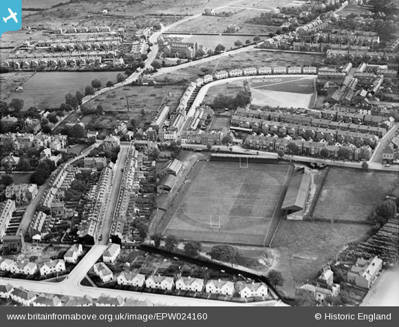
EPW024160 ENGLAND (1928). Rugby ground and residential area, Kingsholm, 1928
© Copyright OpenStreetMap contributors and licensed by the OpenStreetMap Foundation. 2026. Cartography is licensed as CC BY-SA.
Details
| Title | [EPW024160] Rugby ground and residential area, Kingsholm, 1928 |
| Reference | EPW024160 |
| Date | September-1928 |
| Link | |
| Place name | KINGSHOLM |
| Parish | |
| District | |
| Country | ENGLAND |
| Easting / Northing | 383470, 219297 |
| Longitude / Latitude | -2.240121390052, 51.871560768489 |
| National Grid Reference | SO835193 |
Pins

Richcl |
Wednesday 5th of September 2018 02:37:44 PM | |
|
Richcl |
Wednesday 5th of September 2018 02:35:26 PM | |
|
Candia |
Wednesday 5th of November 2014 04:05:13 PM | |
|
Patsy |
Friday 19th of October 2012 04:45:31 PM | |
|
gannett |
Saturday 7th of July 2012 02:22:47 PM |
User Comment Contributions

Kingsholm, Gloucester Rugby, 28/10/2014 |

Class31 |
Wednesday 29th of October 2014 08:29:42 PM |