
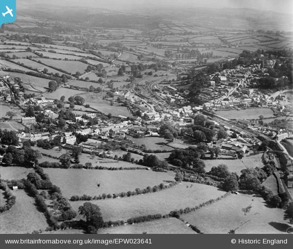
EPW023641 ENGLAND (1928). Newport and St Thomas, Launceston, from the west, 1928
© Copyright OpenStreetMap contributors and licensed by the OpenStreetMap Foundation. 2025. Cartography is licensed as CC BY-SA.
Details
| Title | [EPW023641] Newport and St Thomas, Launceston, from the west, 1928 |
| Reference | EPW023641 |
| Date | September-1928 |
| Link | |
| Place name | LAUNCESTON |
| Parish | LAUNCESTON |
| District | |
| Country | ENGLAND |
| Easting / Northing | 232562, 85205 |
| Longitude / Latitude | -4.3683654248786, 50.641863647279 |
| National Grid Reference | SX326852 |
Pins

MB |
Saturday 1st of December 2012 07:25:39 PM | |
|
MB |
Saturday 1st of December 2012 07:22:48 PM | |

Class31 |
Saturday 1st of December 2012 06:31:35 AM | |
|
Class31 |
Saturday 1st of December 2012 06:31:03 AM | |
|
Class31 |
Saturday 1st of December 2012 06:30:13 AM | |
|
Class31 |
Saturday 1st of December 2012 06:29:47 AM | |
|
Class31 |
Saturday 1st of December 2012 06:29:16 AM | |
|
Class31 |
Saturday 1st of December 2012 06:26:56 AM |