
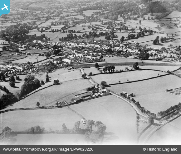
EPW023226 ENGLAND (1928). Honiton and environs, Honiton, from the south-east, 1928
© Copyright OpenStreetMap contributors and licensed by the OpenStreetMap Foundation. 2026. Cartography is licensed as CC BY-SA.
Details
| Title | [EPW023226] Honiton and environs, Honiton, from the south-east, 1928 |
| Reference | EPW023226 |
| Date | September-1928 |
| Link | |
| Place name | HONITON |
| Parish | HONITON |
| District | |
| Country | ENGLAND |
| Easting / Northing | 316944, 100405 |
| Longitude / Latitude | -3.1786330710449, 50.79668481996 |
| National Grid Reference | ST169004 |
Pins
Allen T |
Wednesday 10th of October 2012 12:10:28 AM | |
Allen T |
Monday 8th of October 2012 12:38:54 AM | |
Allen T |
Sunday 7th of October 2012 06:46:54 PM | |
Allen T |
Sunday 7th of October 2012 06:25:12 PM |
