
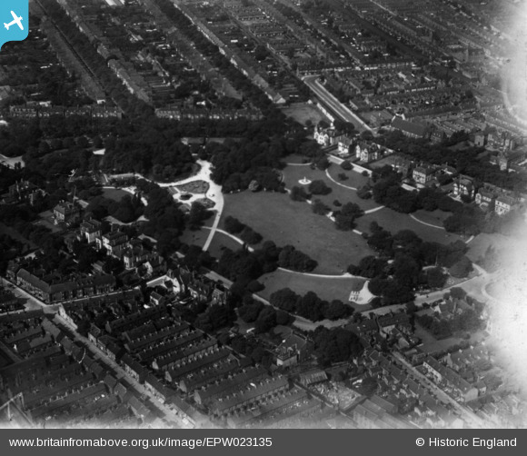
EPW023135 ENGLAND (1928). Pearson's Park, Kingston upon Hull, 1928. This image has been produced from a print affected by flare.
© Copyright OpenStreetMap contributors and licensed by the OpenStreetMap Foundation. 2025. Cartography is licensed as CC BY-SA.
Details
| Title | [EPW023135] Pearson's Park, Kingston upon Hull, 1928. This image has been produced from a print affected by flare. |
| Reference | EPW023135 |
| Date | August-1928 |
| Link | |
| Place name | KINGSTON UPON HULL |
| Parish | |
| District | |
| Country | ENGLAND |
| Easting / Northing | 508605, 430395 |
| Longitude / Latitude | -0.35245981509065, 53.758358657596 |
| National Grid Reference | TA086304 |
Pins

Bodie |
Sunday 26th of April 2020 05:48:14 PM | |
|
Bodie |
Sunday 26th of April 2020 05:47:27 PM | |
|
Bodie |
Sunday 26th of April 2020 05:46:59 PM | |
|
Bodie |
Sunday 26th of April 2020 05:46:14 PM | |
|
John Wass |
Friday 27th of February 2015 08:48:56 PM | |
|
John Wass |
Friday 21st of November 2014 09:21:08 PM |